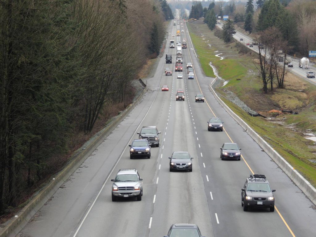
Data. It’s a popular thing these days – everybody wants it – and our traffic count data is no exception.
In our busy province, we study traffic data to help us identify where traffic is going, so we can plan for improvements to better manage that traffic flow. So, what exactly is traffic data, how do we collect it and what does it mean for you?
Traffic Data Explained
Put simply, traffic data is a digital log of vehicle traffic information registered by count stations across our highway network. Permanent count stations collect this information on a weekly cycle and our staff pull that data and add it to our database. Ministry staff uses the data to help support planning, design, construction and the overall operation of the ministry road network.
What Data Do We Collect?
Our Traffic Data program collects data on traffic volume, speed and vehicle length on provincial highways. We often get privacy questions like: Are you capturing my license plate? Rest assured; we don’t know who you are, we are simply tracking vehicles. There is no privacy information collected with this data and so this data is publicly available. We don’t edit data, either. All the data is stored in-house on secure ministry servers and is available through the traffic data website, which is updated on a quarterly basis.
How Do We Collect It?
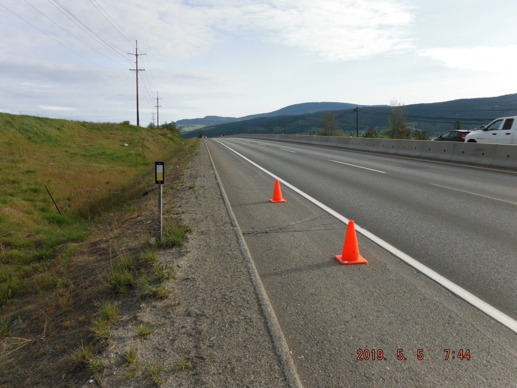
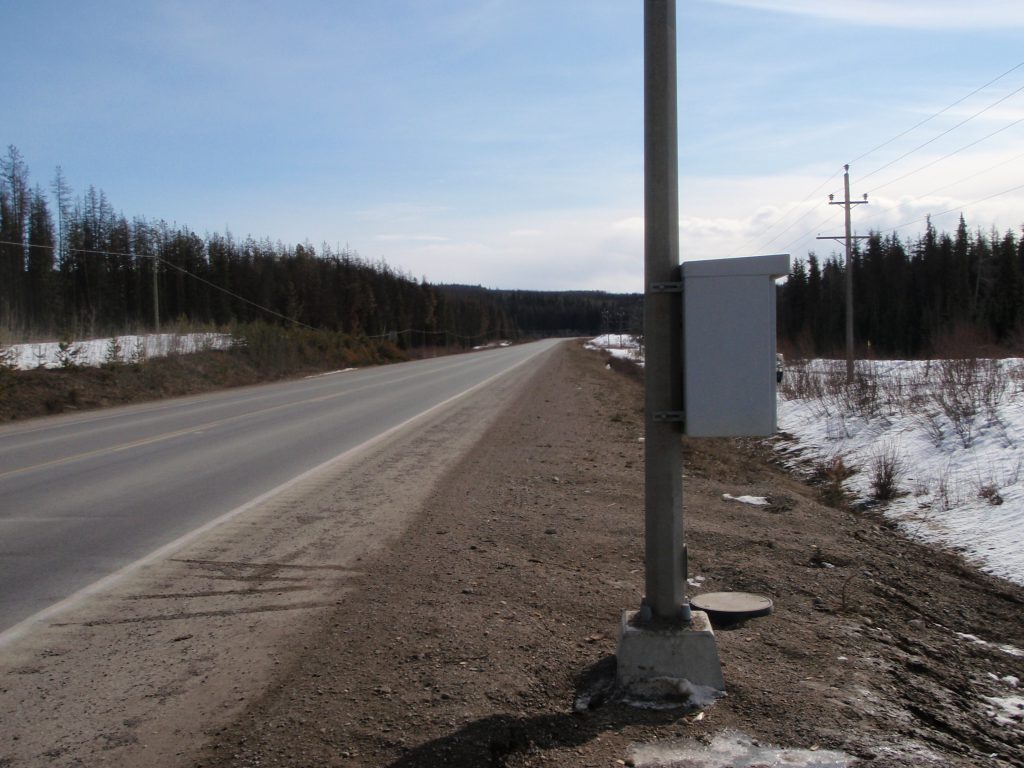
There are currently more than 650 permanent and short count stations in use to collect traffic data on the provincial highway network.
Permanent count stations
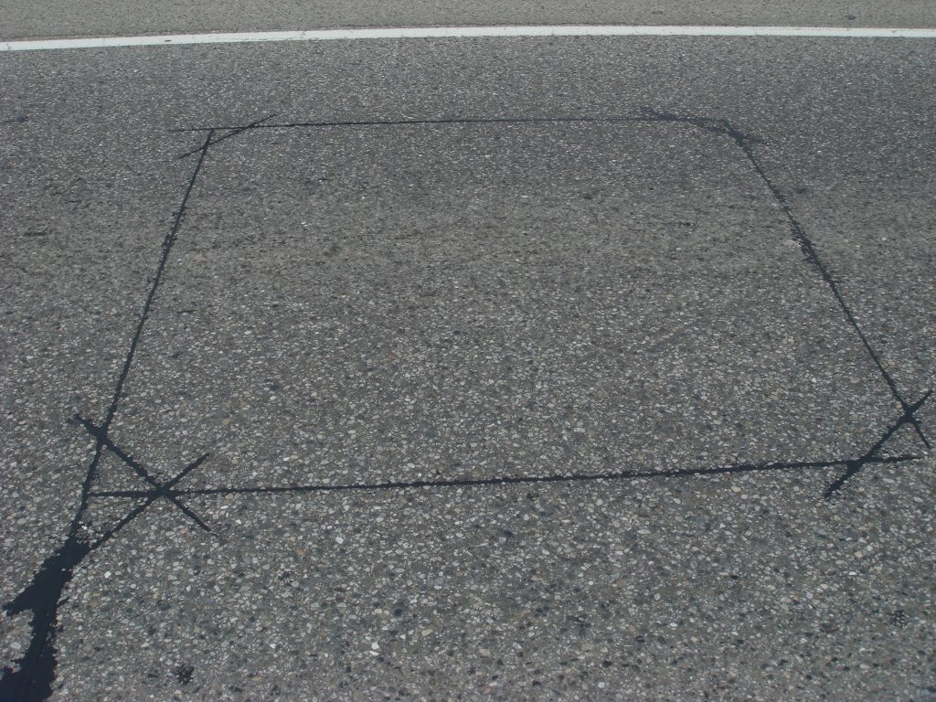
As the name suggests – these stations occupy a permanent location and collect traffic count data 24 hours a day. These stations are connected to inductive loops which are placed into the roadbed. Inductive loops (which are basically electrically energized wire) detect the metal content of a vehicle. When a vehicle rolls over the loop, it changes the magnetic field around the loop, the counter recognizes that changes and adds that vehicle to the data count. A single loop can measure volume in a lane. A pair of loops (located in the same lane, four metres apar) detects when the front of the vehicle goes over the first loop and when the end of the vehicle passes over the second loop is able to measure length and speed. Piezoelectric strips can also estimate the load on an axle and are used in weigh-in motion sites in conjunction with loops.
Short count stations
Temporary or short count stations are activated over small windows of time (48 hrs or more) each year. We use these stations to get a pulse on any traffic pattern changes to better understand how and why traffic is changing in each location.
What Does Our Traffic Data Do For YOU?
We monitor traffic data for a variety of reasons. The most common reason is to help us determine the impact of changing conditions on our roadways (i.e., traffic increases or decreases, type of traffic on a certain road). If a road network changes for any reason, say for example if construction begins on a major project, we monitor the data to determine where traffic volumes have shifted or changed. Understanding travel patterns and behaviours helps us decide where we need to focus for planning.
Ministry staff use traffic data to help plan projects or to help develop business cases. Our staff in the Commercial Vehicle Safety Enforcement (CVSE) group often need data on vehicle lengths and weights to understand where commercial vehicles are travelling. A lot of our ministry guidelines reference volumes as a key consideration when determining how to design our roadways. We also use the data in our traffic modelling and forecasting to understand traffic light operations at intersections and our signal timing.
Some other interesting uses for our traffic data include:
- operational reviews
- student research for innovation and development
- news media requests
- Attorney General court case use
- wildlife migration
- real estate inquiries
- forestry and other industry requests
- new (and existing) businesses access data to help develop or update business plans
- capacity and movement during wildfires and other emergencies
How Do We Decide Where to Place Our Stations?
We order our highway system into uniform traffic volume segments (Point A to Point B). For each segment there is a count station within it. At a high level, that count typically tells you what the traffic volumes are for that stretch.
When the ministry delivers a project and the alignment on the highway changes because of the work, a new count station is typically installed as the distance between point a and b has changed. We look at ways to include the installation of new stations under the delivery of new, larger projects (such as interchanges), as they will be fixed for a long time and can act as a good point for data collection on the movement and volume of traffic in the area.
So, there you have it. Our traffic data program in a nutshell. Obviously, the biggest benefit of traffic data is its use to help us understand who is using our infrastructure, so we know where we can spend our dollars in the best way. Have you used our traffic data? What did you use it for? Let us know in the comments below.
If you found this article interesting, you might want to check out these related blogs:
How to Pick the Best Route for Your Metro Vancouver Commute
Four Stages of a Mega Project – An Insider Perspective
How the Lions Gate Bridge Counterflow Works
Talk About an Information Highway – Open 511 Meets DriveBC
Excellent synopsis of our Traffic Data Program and the significance of traffic data on our work. Thank you!
Thanks for the kudos, Michelle! We will share it back with our team. Safe travels!