It was the most destructive wildfire in the province during the record-breaking 2017 wildfire season, covering 192,000 hectares at its peak.
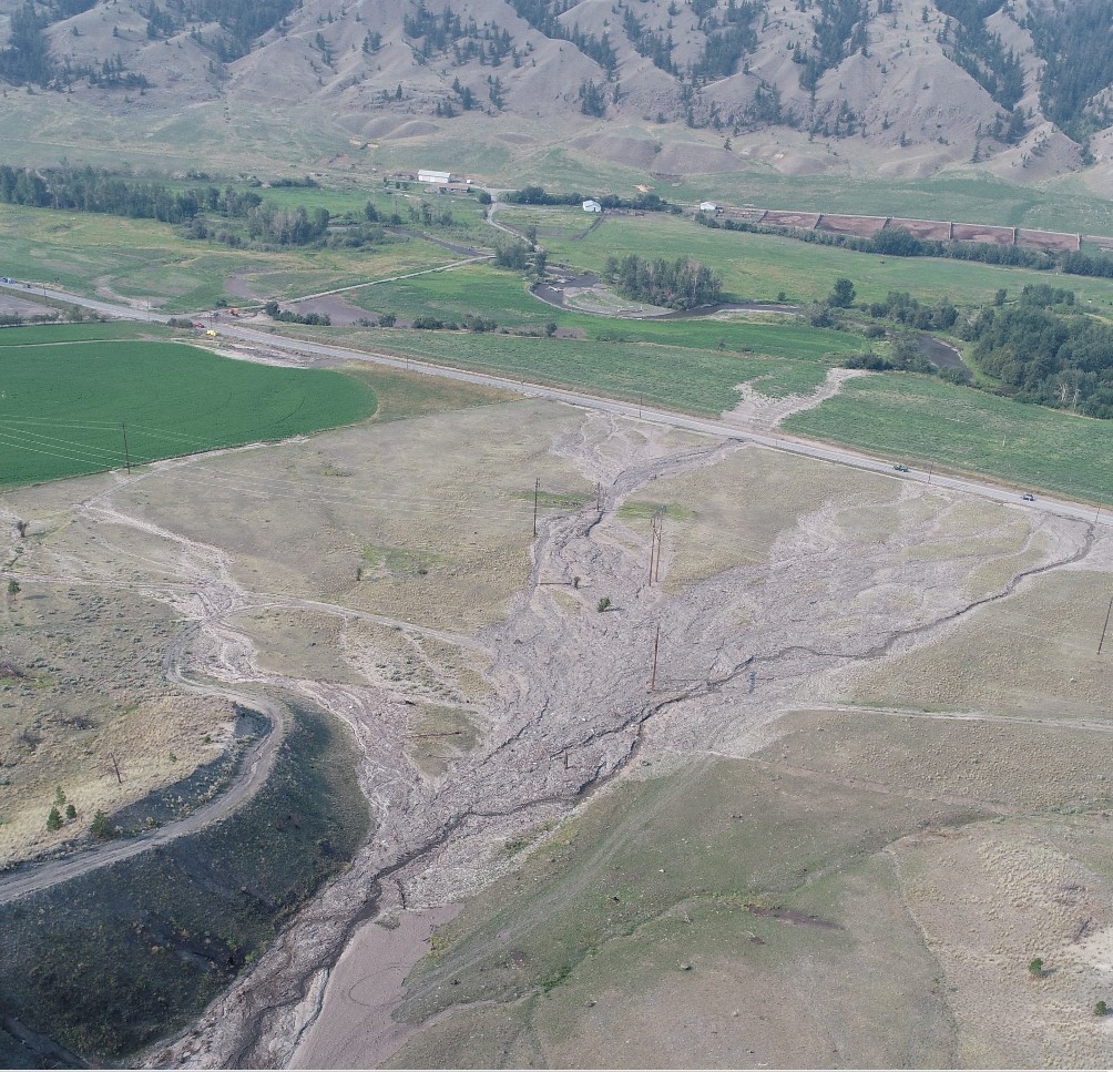
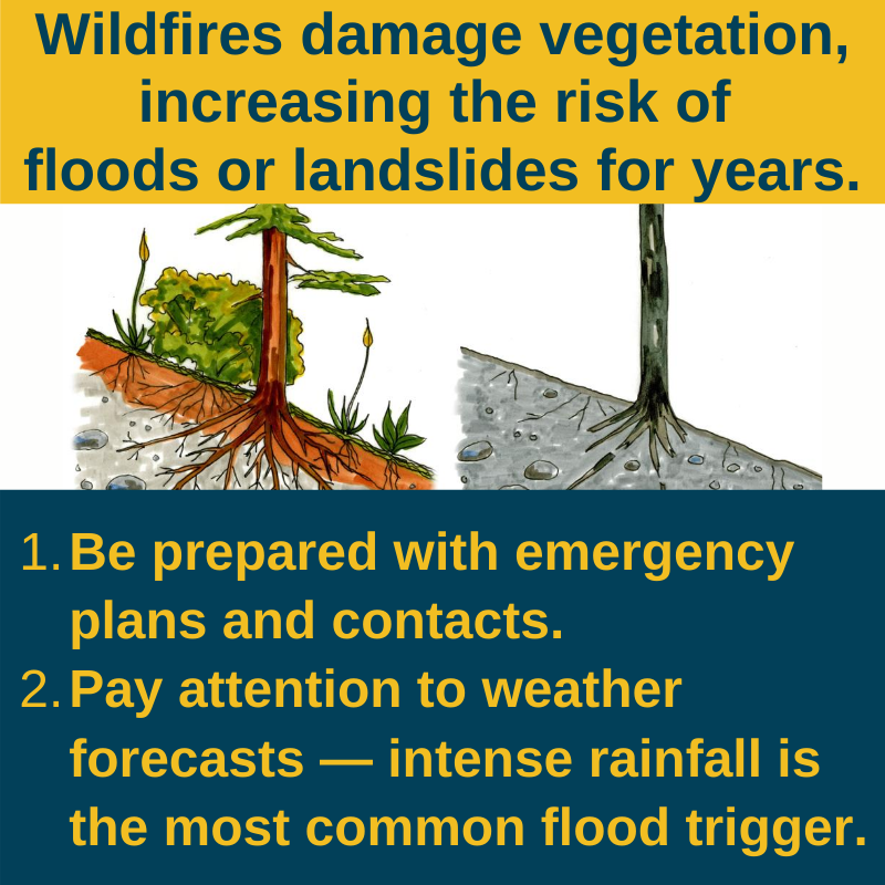
The Elephant Hill wildfire began south of Ashcroft, destroying more than 120 homes and forcing thousands to evacuate including the community of Cache Creek. Unfortunately, the impact didn’t end there. The wildfire also severely damaged vegetation in the area creating a condition call hydrophobic soils which causes increased risk of runoff, erosion and debris flows or debris floods. Several intense rainfalls after the fire caused damage, flooding and drainage issues, and prompted us to put the Elephant Hill Improvement Project in place.
What exactly is the Elephant Hill Improvement Project?
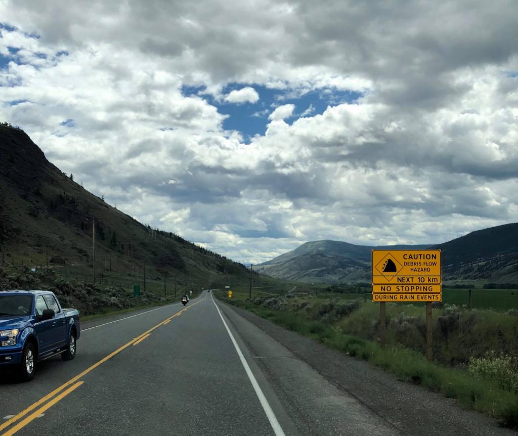
In order to keep the travelling public and residents moving safely through the impacted corridors, we created a plan that focuses on weather forecasting, monitoring and reporting at the site. Roadside signage was installed to notify travellers and residents of the hazard. As well, an on-site weather monitoring and warning system was installed and implemented.
How does the plan work?
In addition to reviewing detailed, local weather forecasts, we’ve installed rain gauges in strategic areas to actively monitor the weather conditions in real-time. The gauges collect data that correlate to protocol responses for various rainfall intensities. When a weather incident with the potential for debris flow, debris flood, or flooding is forecast, we proactively communicate the risk to the public via our overhead dynamic message signs, roadside warning signs and information bulletins and across our social media channels, advising motorists not to stop if they are travelling through the area.
As the risk increases that an event may be triggered, we have on-site monitors who observe the road conditions and weather applications closely, and if needed, the ministry closes the highway proactively to keep travellers from risk. Warning signs are in place along a stretch of Highway 97 from Cache Creek to just south of Clinton, and on Highway 99 near Lillooet (in addition to back roads in the area) to remind motorists that they are in a slide area.
Hazards such as debris flows and debris floods are expected to cause issues for several years after a wildfire of this magnitude due to the hydrophobic soil. Once the vegetation has had time to re-establish, the soils are broken up by roots and the slopes and channels will become more stable and the risk will decrease. We will continue to monitor the weather conditions and implement the safety guidelines until the risk has depreciated.
If you liked this blog, check out:
Three Ways We are Working to Protect BC Highways from Climate Change
Are these the Most Amazing Emergency Vehicles in BC?
How Hydrotechnical Engineers Keep Water Under the Bridge
Emergency Signs on BC Highways and What they Mean
Do you have any questions about this project or any other work we do at the BC Ministry of Transportation and Infrastructure? Let us know in the comments below.
Join the discussion