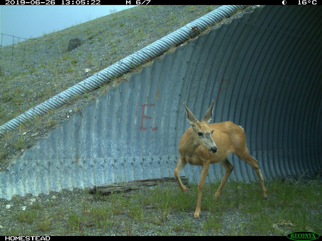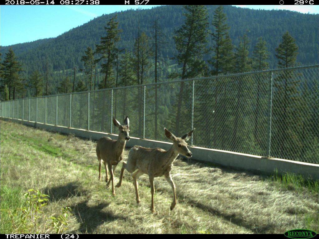
Not until now have we been able to demonstrate how important wildlife crossings are for preventing collisions between highway travellers and animals.
Sure, we can show photographs of moose, badgers, deer, snakes – you name it – from the many Wildlife Monitoring Program cameras located across the province. And we do. But on their own, these photographs don’t show the big picture, the tremendous impact, quite like visually presenting an entire year’s worth of wildlife crossing data for a single species in 30 seconds (in this case: our feature animal is the mule deer).
So, that’s what we’re doing now. We’re pretty sure this is the first time, anywhere, wildlife crossing data has been presented on such a large scale. And we’re very excited about it (can’t you tell?).
What the Video Shows (and Why it’s Important)
The video shows a map of the Okanagan Connector (Highway 97C) between Aspen Grove and Kelowna, which is prime mule deer habitat. The map includes the wildlife crossing locations of 11 underpasses and one overpass (most, but not all, wildlife crossings on this stretch of highway). The wildlife overpass is the location furthest to the east, nearest to the Highway 97 junction.
You’ll notice the wildlife crossing locations start lighting up with triangles, slowly through the winter months, then faster through the spring and summer months as the mule deer become more active in their movements. It’s evident that, as soon as the snow melts, the mass movement of mule deer proves to happen very quickly.
You’ll also see the triangles vary in size and colour, depending on the number of mule deer and their direction of travel.
By the end of the video, mule deer are shown to have safely crossed Highway 97C 3,700 times using wildlife crossings.
“Watching those numbers climb really impresses me,” says Dr. Leonard Sielecki, manager of our Wildlife Program.
“And this is only showing mule deer – not other types of deer, or other species of wildlife. It means the potential for 3,700 collisions with vehicles was eliminated. These mule deer were not hurt, killed or orphaned – they crossed the highway safely thanks to the crossings made for them.”

Daunting Data Collection
The quest to understand animal behaviour near BC highways is hard, and yet critical for reducing collisions between wildlife and travellers. In this case, species specialists manually sifted through thousands of images captured by wildlife cameras to determine the numbers of mule deer using each crossing in the video.
Going through all the images by hand takes time, but it also reveals valuable information beyond sheer numbers. Determining species, age, sex, and the size of herds gives us better understanding of the dynamic of herd movements.
It also helps us identify ways to improve crossings. For example, we noticed that some structures were becoming blocked with heavy snow accumulation, leading us to figure out how to modify entrances to keep them clear.
What’s Next?
This is just the beginning – we plan on pulling together similar crossing data for other species in the future, most likely continuing with moose next. We’re also working on ways to make the data collection more efficient. To speed up the analysis, for example, we’re working with computer engineers to develop artificial intelligence and deep learning techniques for identifying species of wildlife in photographs.
We know people love BC wildlife. And this video is designed to make data about mule deer movements, and the ways they are protected, understandable for a wide range or people – from kids to academics.
If you found this blog interesting, please check out some of our related content:
>> Gettin’ Licky With It: Intercept Salt Patch Saves the Day
>> BC Highway Wildlife Cam Captures Moose Selfie and More
>> Behind the Scenes: BC Wildlife, Trucks Save from Collision
>> Watch What Happens When Moose Meet Wildlife Underpass
Do you have a question about how we monitor and protect wildlife near highways? We welcome your comments below.
This is impressive and great! Please publicize it a bit more. I will share it. And continue to expand the crossings. Thank You.
Thanks for your support, Susan!
I am wondering if a wildlife crossing is being considered or could be looked at around the 16 mile area north of cache creek. I have lived in this immediate area for the last 20 yrs and every year the section of highway from 16 mile to 20 mile is an absolute slaughter in the spring and fall when the mule deer are migrating to their summer and winter ranges. The traffic volume has increased dramatically over the past few years and we see wildlife encounters with vehicles on an almost daily basis. There is not even a wildlife crossing sign in the area. Although I do question the effectiveness of such signage it would perhaps help as well. With the mule deer population in this area in serious decline I believe this is an absolute must project to be looked at. Not to mention the ICBC claims that must be arising do to animal encounters in this area.
Hello Robert and thank you for your comment and suggestion. We have sent your message to our environmental team responsible for the area and will let you know what we hear back from them. Stay tuned.
Hello again Robert,
We shared your comment with our staff who informed us that the ministry installed a wildlife crossing at the Cargyle Curves four-laning work which was completed a few years ago. (We are still waiting for confirmation on exact coordinates of this location). We always look to improve wildlife corridors as a part of the delivery of larger projects across the province. We hope that this information is helpful. If you have any other questions or concerns, don’t hesitate to let us know.
Further to our last comment, the coordinates of the location of the wildlife crossing in your area is at 50.986851 -121.515682. Hope this helps clarify!
Awesome visualizations friends! Have been sharing!
Thanks Candace – we love hearing that. 🙂
A very interesting presentation of the data! Well done.
Thanks Tony! We think so too 🙂 Appreciate you sharing your feedback!
As I travel from my home in the Kootenay’s to work locations all over the province it is very evident that these animals are creatures of habit and of inherent learning. There pattens of movement are very predictable as well as confined to typography. ICBC funded management would be very cost effective. Just think 10 large animal strikes per day provincially (an estimate) costs an average of $10,000. It will not take long to recover costs, as well, most importantly, reduce the impact on wildlife. In most cases they are just going for a drink of water!
Thank you for your suggestion Blair – we have sent it to our Environmental Management group for their consideration. Safe travels.