History nerds – get ready! We’ve fired up the Road Trip Time Machine and pointed it at BC Highway 3 for a look at this iconic road as it was between Princeton and Crowsnest on the Alberta border, in 1966. Woooo hoooo!
Beginning just outside of Hope and running along the southern edge of the BC and across the Alberta border, BC Highway 3 (also known as the Crowsnest Highway or the Southern Trans-Provincial), is an important route for travellers in and out of our beautiful province. These videos pick up where we left off in our last installment on BC Highway 3 as it travelled between Hope and Princeton. From Princeton, we head southeast past Hedley and Keremeos towards Osoyoos. From Osoyoos, the time machine travels east toward Creston. Leaving Creston, the time machine travels through Cranbrook, Fernie and onto towards Crowsnest. There’s a little bit of everything in these reels – small towns, rivers, mountains, valleys, orchards, lakes and more. So – climb in and buckle up – you won’t want to miss a frame.
Ch-Ch-Ch-Changes!
As with all things – the only true constant is change – and this route has seen its share of changes over time. Along with many standard safety improvements, such as widening, new alignments, improved signage, turning lanes and exits, the ministry has also worked hard to create new, more efficient connections between communities on the corridor.
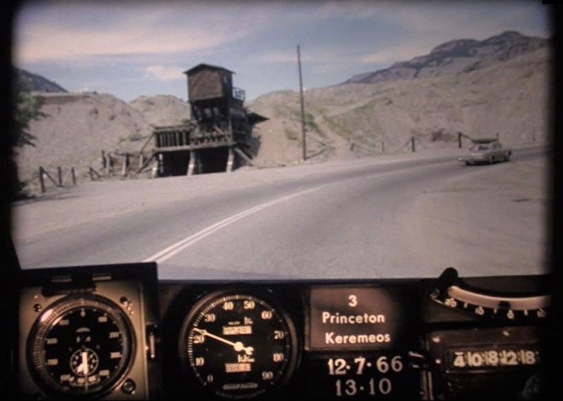
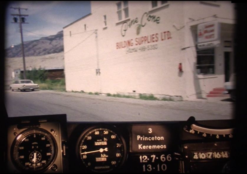
Princeton to Osoyoos
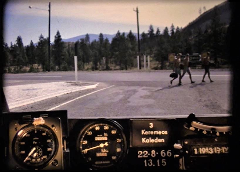
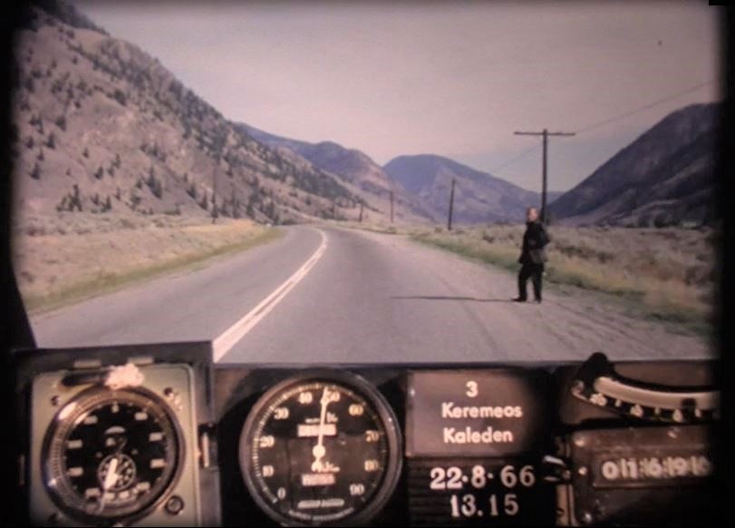
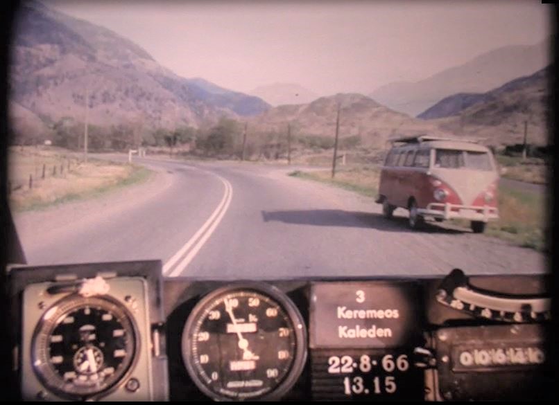
Before the road through Richter Pass opened (connecting Keremeos directly with Osoyoos), travellers had to take Highway 3 north from Keremeos to Kaleden. From there, travellers then had to travel south towards Osoyoos and eastward again toward the Alberta border. The Keremeos – Kaleden route is now designated as Highway 3A.
Did You Know? Until the opening of BC Highway 97C (aka the Okanagan Connector) in 1990, Highway 3 was the fastest route connecting the coast of BC to the Okanagan.
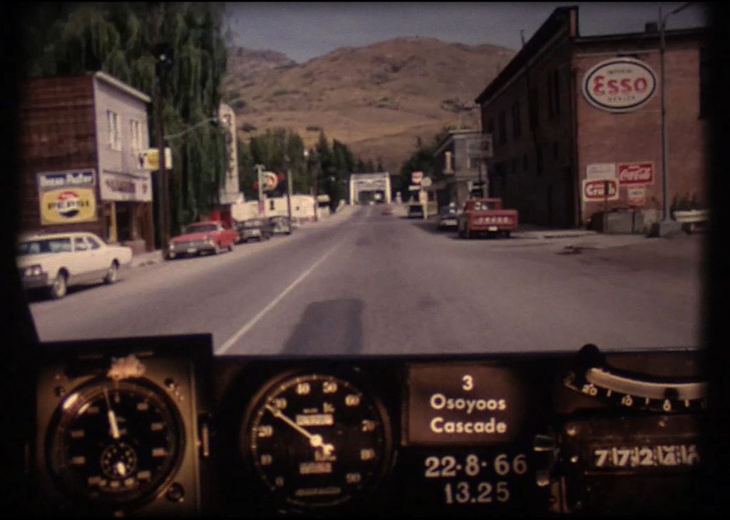
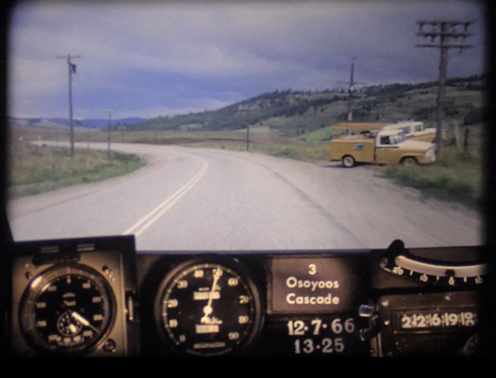
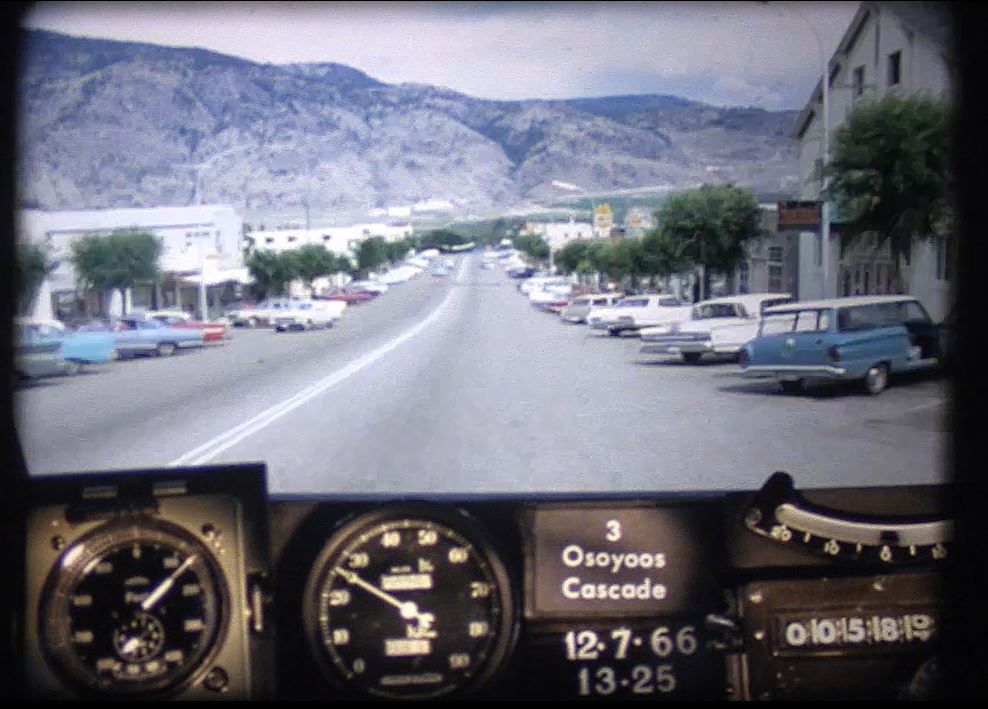
Osoyoos to Creston
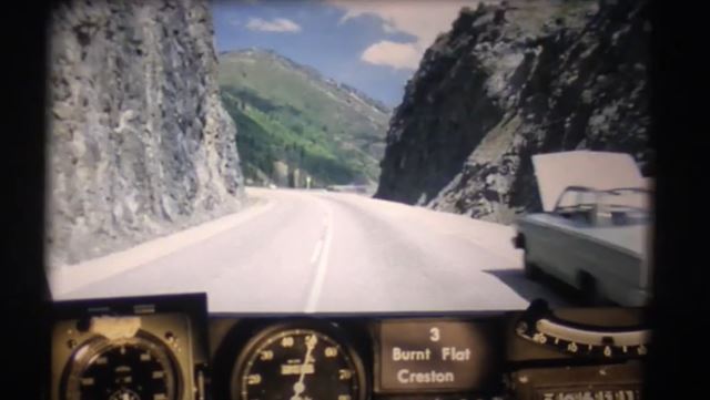
Many new alignments will be visible to locals familiar with this stretch. Gone are the Greenwood Tunnels (well, one tunnel does remain, but the highway now goes around it). Blink at 23:51 and you miss the community of Blueberry – now just a memory. In 1966, traffic had to pass through Salmo (via present day Airport Road) to travel west to Burnt Flat and Kootenay Pass. The Kootenay Pass (aka Salmo-Creston Cut-off) was only two years old at the time this video was captured. We counted five cars pulled over along the Kootenay Pass due to overheating – an issue that still happens today – as this is the highest point on the Crowsnest highway. Also notice, the “Big Cut” taking travellers to the intersection with Highway 3A isn’t there, meaning travellers had to go down Highway 21 and back up Hood Road to get there.
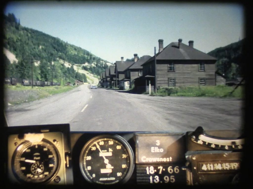
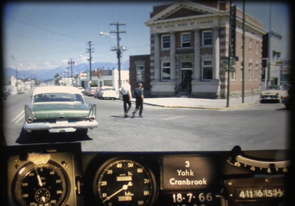
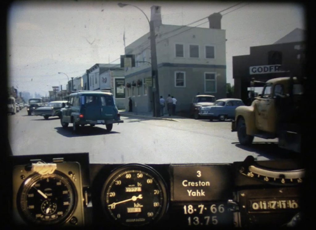
Creston – Cranbrook – Crowsnest (Alberta border)
Many parts of this stretch will look familiar to local travellers, including the community of Cranbrook. Wherever possible – the ministry continues to make improvements – such as widening, barrier installation and turn lanes for added safety. A big change to note since 1966, is the shuttering of the coal mining towns of Natal and Michel, close to present day Sparwood. This once thriving community is now only a memory, but time travellers can get some very cool snapshots of the community, as it was, near the end of the reel.
Community Names
Cascade, Kinnaird, Kaleden , Tadanac and Waneta were once communities significant enough to be used as directional start and end points to sections of highways in these photologs. While these communities still exist, their importance as a directional marker has “gone by the wayside”. Oh, and speaking of names, at the time this video was captured, BC Highway 3 was more commonly referred to as the Southern Trans-Provincial, reflecting its importance as a primary route in and out of the province. It wasn’t until 1977, that the entire stretch was officially named “Crowsnest Highway”.
Where Did These Videos Come From?
These videos are called “Photologs”. They were created by the ministry as a tool to capture road condition information across the province and give our engineers the ability to study a particular stretch of road without having to travel into the field. These original photologs were collected by rigging a camera onto the dash of a car which took still images every 80 feet or so and then running them all together as a single film. You can see them all on our YouTube channel.
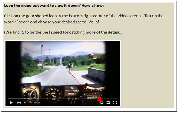
Video Moving Too Quickly?
Did you know that we slow these videos down to about 25 percent of their original speed before we share them? Even then, they can move pretty quickly. If you blinked and missed something – don’t worry – we’ve done the leg work for you and collected a great selection of still images over on our Flickr channel. Otherwise, follow the steps outlined in the image below, to reduce the speed even further.
What Did You See?
Did you notice something in this video that is long gone or something that has been there for, like, ever? Let us know what you see (or don’t see) in the comments below and stay tuned for more episodes as we work our way through the rest of the 1966 photolog footage.
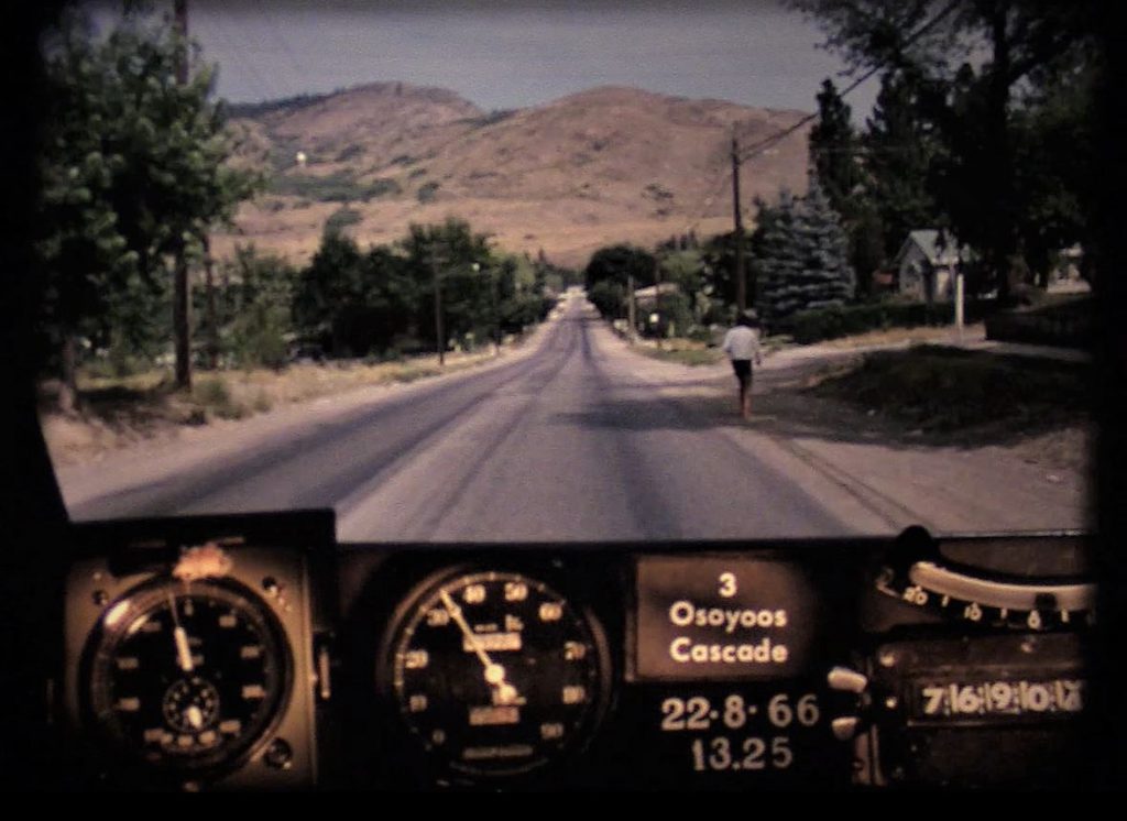
Looking back on these old reels reveals a lot more than just pavement condition. The camera captured some incredible snapshots of our province during the 60’s. We loved catching a glimpse of three shirtless boys, walking along the highway on a warm summer day (gave us a real Stand By Me vibe). We also spotted a farmer driving his tractor and combine on the side of the highway in the Similkameen Valley, and a hitchhiker dressed all in black, just outside of Princeton. Oh, and – PUNCH BUGGY! No returns.
Want to see more about the history of BC highways? Check out these links below:
- BC Road Trip Time Machine: Travel Back in Time to the Interior of BC as it was in 1966
- A Brief History of the BC Highway Traffic Patrol
- Who is the Highways Department? A Study in Historical Pictures
hi tran bc editor. I was born in 1953. and we went on trips to the okanogan to Penticton .as this hwy 3 was the only way there .when I got older, I drove the dead buzzard Highway a lot. As a professional driver that’s what we used to call it Hwy 3. I and most people didn’t even know this type of photography ever existed. I would like to give credit to the people that have put this together, it is absolutely amazing to be able to go back in time and see this. I pulled that hill ,salmo to Creston many a time in my career. and my older brother lives in Cranbrook.the only thing I would say is your last pictures, are in wrong order Creston should be before Cranbrook.is there any reals of hwy 97 . out of hope up the Canyon North too, 100 mile ,Williams lake, Prince George etc.etc. again thanks too every one for the great work putting this all together.
Hi there, Terry
Thanks so much for your kind note (and the heads up about the ordering). The videos are a labour of love by yours truly. 🙂 We have captured the Fraser Canyon and are working on the stretch from Cache Creek to PG right now, so stay tuned. Here’s a link to all the videos we have done so far. Hope you enjoy. Safe travels. https://www.youtube.com/playlist?list=PLKHNpQ_j-IWG8CG_KN7cwl5mMO2bz2x8w
thanks again for all your hard work and team.the link u sent is very very cool .iam sending this out to my brothers. and grandkids etc .looking forward in see the 97 hwy north. I live near 100 mile.
Excellent – our Highway 97 between Cache Creek and PG is now live on the list: https://www.youtube.com/watch?v=ZaH7Yl3u5bc&list=PLKHNpQ_j-IWG8CG_KN7cwl5mMO2bz2x8w&index=37
Thanks again, Terry.
Thanks for the vid. Do you have the Hope-Princeton section for it? It would be interesting to see how it looked before the slide (if it predates it).
Hi Bill,
We do and you can watch it here: https://www.tranbc.ca/2016/09/22/travel-back-in-time-to-the-hope-princeton-highway-in-1966/
A note though, that this stretch was captured during the same time frame as the others – 1966 – which means it doesn’t capture the Hope-Princeton as it was before the slide. It does capture the post slide area very well though.
You might also be interested in this photo blog we created highlighting the area in the days after the slide occurred. https://www.tranbc.ca/2020/01/08/a-bc-highways-perspective-of-the-hope-slide/
Wow epic stuff I love it!!!
Thanks Dann. We think so too!
I travelled this route for the first time last fall(little window of opportunity) and absolutely fell in love! Look forward to doing it in more detail when we can travel again.
How lucky for you, Carolyn! It certainly is a beautiful stretch of road. Safe (future) travels!
Lots of excellent changes!!
We’re glad to hear you like it, Shirley!
Think I saw my dads 57 light green Ford parked along the road at Cominco (Teck) 25:59 when he was at work. Not many if any of that particular color in town at that time. Interesting how the camera was stopped just as it was starting to go through Cominco on a super smoky day. A few black frames then suddenly the area is much less smoky. And I also noticed a few broken down cars along the way. They most certainly were not as maintained/reliable as they are today. So many things I could say about parts of this video as I was 14 at the time.
Hello Steve – what a cool thing to see! It sure was smoky in the area at that time, wasn’t it. Our thought might be that the visibility was too poor to include those few frames? Let us know what else you can see!
As a kid, our family traveled from Langley to Cawston to visit my grandparents a couple of times a year pre 1966. Parts of the highway hasn’t changed much since then from Princeton. Still a nice drive and brings back great memories. Tricky part of the drive was Hope to Princeton and would be great to see some old footage of that part of Hwy 3
Thanks for your comments, Watne. The portion from Hope to Princeton has also been captured – here’s a link to more on that: https://www.tranbc.ca/2016/09/22/travel-back-in-time-to-the-hope-princeton-highway-in-1966/
Usually most summers I drive from Vancouver to Winnipeg to visit family. In 2019 I decided to take The Crowsnest instead of The Trans Canada through the mountains, let’s just say highway 3 was an incredibly enjoyable drive all the way from Hope BC to Medicine Hat AB. I found it to be much more scenic and the small towns along the way were interesting. Once I can travel again this will be the preferred route going forward. Amazing at how much has changed on it since ’66 though, incredible!
It certainly is beautiful! After producing these reels – yours truly has decided to do the same (when travel opens up once again). Thanks for sharing, Ken.
Great to see these old video logs. Many thanks Jasbir.
If you see any for Hwy 97 between Penticton and Okanagan Falls circa 1980 please let me know.
Many thanks
John
We will add your request to the list, John. At this time, we are still working through 1966. Safe travels!
Awesome work.I drive on hwy no 3 pretty often,working for railway.Keep sending emails regarding this kind of work.Thank you.
Glad to hear you liked it, Jasbir. Thanks for commenting and safe travels!