If you’ve driven in Canada, chances are pretty good you’ve been on the Trans-Canada Highway at some point. Stretching from coast to coast, it’ll take you through all 10 provinces and show you some fantastic sites to see along the way (here are a few of our favourites).
But as you’re travelling the Trans-Canada, have you found yourself wondering how it came to be? Or how many other vehicles are travelling the road with you? Well, we’d rather you stop wondering and keep your focus on the road.
So when you have a minute, pull over and check out this list of fun facts we’ve put together for you about our favourite national highway:
- The system was approved by the Trans-Canada Highway Act of 1949.
- The Trans-Canada highway officially opened in 1962, and was completed in 1971.
- The opening on the Trans-Canada was celebrated twice, once by a provincial event July 30th, 1962 and then by the federal government on September 3rd.
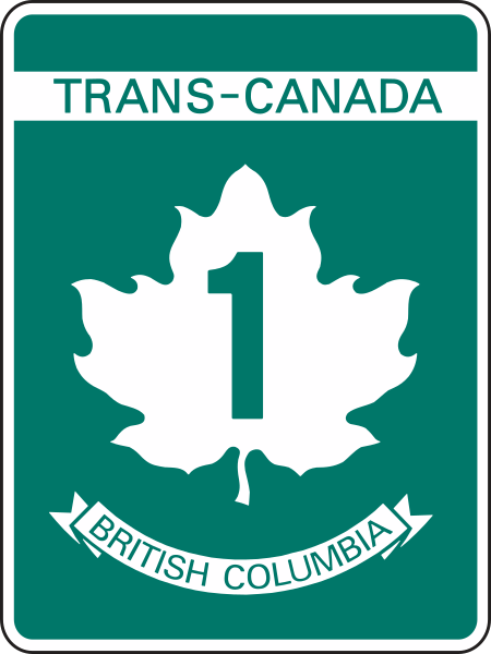
- The Trans-Canada highway system is recognizable by its distinctive white-on-green maple leaf route markers.
- The highest spot on the Trans-Canada is the Kicking Horse Pass with an elevation of 1643 m.
- The Kicking Horse Canyon section of the Trans-Canada Highway carries 10,000 vehicles per day during the summer. Of that, 24% is heavy traffic, which is five times the provincial average.
- At 10 lanes, the new Port Mann Bridge is one of the widest in the world.
- At nearly 8,000 km, the Trans-Canada Highway is one of the longest national highways in the world (Australia’s Highway 1 beats it at over 20,000 km).
- The Confederation Bridge connects New Brunswick to Prince Edward Island and is the longest bridge over ice covered waters in the world.
- There are two places that claim to be the western terminus of the Trans-Canada Highway – Victoria and Tofino.
And there you have it. Armed with those little tidbits, you too can be a titan of TCH trivia and amaze your friends on your next road trip. They also make handy ice-breakers at parties.
If you’re interested in learning more about the Trans-Canada Highway, we’ve got lots more for you to check out here.
Will you guys consider building a fixed road link connecting departure bay to horseshoe bay? This will link Vancouver island to the rest of Canada
Hello, Anonymous – thanks for your continued interest on this topic.
We note that we have provided you with the information below in response to previous, similar questions.
We would like to confirm that you are, in fact, receiving our responses?
Technology does continue to improve but the real issues are the environmental factors, combined with the cost to build and maintain structures. Even if we were to have the incredible budget required to “build new islands”, we would still be left with the feat of crossing the Georgia Strait, where you’re looking at a crossing of up to 26 kilometres and depths of up to 365 metres. That’s deeper than the Eiffel Tower is tall. And even when you reach the bottom, it’s not a nice, solid foundation – you’ve got to go through many metres of silt before you get there. Dubai and China have done land reclamation in areas with depths nowhere near as deep. It’s also an active shipping channel, prone to seismic activity, extreme waves and high winds… not exactly ideal conditions for a bridge.
Hope this is helpful.
I am a different person that asked this question
Can you guys consider to construct a freeway through Victoria BC from the Mckenzie/Admirals interchange to Black ball ferry to reduce congestion and improve safety?
Good morning,
Our jurisdiction of the TCH south of Admirals continues to Cloverdale Avenue. After that point – Douglas Street becomes the responsibility of the City of Victoria. As this is the urban centre of the city, it is unlikely that there will be a freeway considered here but we encourage you to reach out the City of Victoria to confirm. Safe travels.
Will you guys consider building overpasses until Cloverdale Avenue from the Mckenzie interchange to help reduce congestion in Saanich and around the Greater Victoria area?
There are no plans to build overpasses between Admirals and Cloverdale at this time.
Pls built good truck stops on hwy 1 between hope to calgary with full facilities drivers face too much difficulty to find one spply in winter it becomes worse to worsed that frustrated commercial driver which lead into speeding accidents
Hello Talwinder – thanks for your comment. There are a number of rest areas which accommodate commercial vehicles between Hope and Calgary. Here’s a link to the page with more info: https://www2.gov.bc.ca/gov/content/transportation/driving-and-cycling/traveller-information/provincial-rest-areas/map
Hope that this is helpful.
Are all the facilities open in winter? Talwinder specifically mentioned winter
Hi Colin,
Some rest areas are closed in winter. You can see which are “Open Seasonally” (i.e. warmer weather) by looking at the rest area map: https://www.th.gov.bc.ca/restareas/?zoom=5&loc=-126.600000%2C54.589121 The rest area symbols in red are the ones that are not open year-round. More about BC Rest Areas: https://www.tranbc.ca/2014/06/06/bc-rest-areas-9-things-you-need-to-know/
Personally, I think this was wonderfully helpful and interesting-
don’t mind them 🙂 thank you for your hard work
Thanks Caite 🙂
hey please add more facts this wasnt really that helpful
Hi Derp – are there any facts specifically you are looking for which aren’t included?
What are some environmental issues with the trans canada
Hi there,
Is this question in regards to a specific section of the Trans Canada in BC?
this stuff is not true and it is not good at aaaaaaaaaaaaaaaaaaaalllllllllllllllllllllllllllllllllllllllllll!!!!!!!!!!!!!!!!!!!!!!!!!!!1
Hi Anonymous,
Is there a specific fact you have concerns about? We would love to clarify any issues. Let us know, thanks!