It’s no secret, we’re big on safety for the travelling public. In fact, it’s our driving concern, and weather information is a big part of that.
One way we help drivers stay safe is by closely monitoring environmental conditions on our roads with our Roadside Weather Stations (RWS). A key part of our Intelligent Transportation Systems (ITS) – these stations collect data on weather and pavement conditions from strategic locations. This information is a powerful tool for operational decision making for our highway maintenance contractors during winter operations.
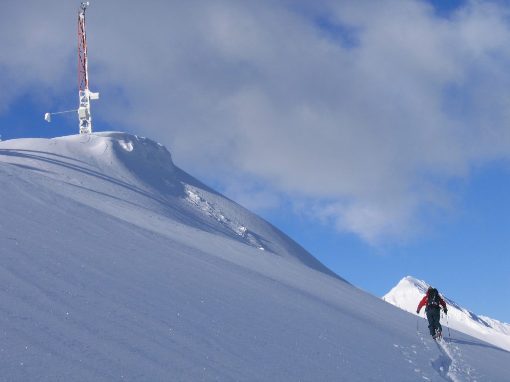
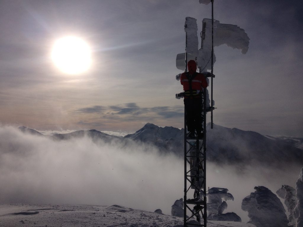
It All Began High Up on the Mountaintops
Back in the late 1970’s, we recognized that a new generation of weather monitoring equipment would allow our Avalanche Technicians to monitor weather conditions as they happen and right at the source – way up on the mountain tops where avalanches start.
At that time, a handful of independent stations were used to send weather information to our offices, where the techs would review the data and organize avalanche control, as required. Since that time, our weather monitoring program has grown into a sophisticated network of environmental sensing stations that help us in several ways.
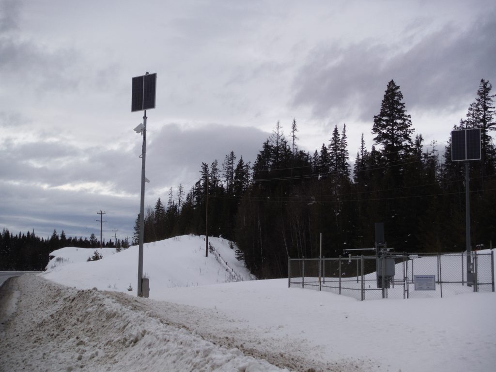
Road Weather Stations
Road Weather Stations (RWS) are installations of weather instruments that collect data on weather and pavement conditions from strategic locations across the province.
Our weather network includes 99 road weather stations, 67 avalanche weather stations, and 94 frost probe stations and all the stations in our network are installed and maintained by our dedicated team of Environmental Electronics Technicians.
Information from these stations is collected and distributed to a wide number of stakeholders through a single Snow Avalanche and Weather System including:
- Environment Canada,
- Various university-based research programs,
- The Canadian Avalanche Association (in support of the Public Avalanche Bulletin program),
- Weather forecasting contractors who supply forecasts to our maintenance contractors and Avalanche Technicians
The provincial Frost Probe Network is the latest addition to our network. It allows us to monitor the seasonal strength of the highway – reducing the risk of costly damage to our highways from heavy commercial vehicle loads in during the spring thaw, while minimizing the impact of load restrictions on BC’s economy.
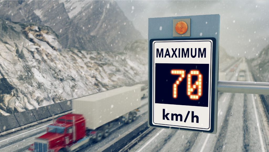
RWS and Variable Speed Limit Systems
Our RWS also play a key role in BC’s Variable Speed Limit Systems (VSLS). The VSLS systems require a dense network of optical pavement sensors to detect potentially hazardous winter conditions and recommend appropriate speed limit reductions when appropriate.
These sensors are a relatively recent innovation, replacing embedded pavement temperature and condition sensors in the asphalt road surface with a pair of optical devices that look down on the road surface from above. Optical pavement sensors are typically located about 10 km apart, monitoring conditions in both directions of travel. They measure pavement surface temperature with an infrared thermometer and use a multi-channel spectral sensor to measure the thickness of any water, snow, or ice on the road surface. These measurements determine the surface condition (eg. dry, moist, wet, slushy, snowy, or icy) and the degree of slipperiness on the surface of the road.
There are currently 33 sets of optical pavement sensors being used to provide detailed data on road surface conditions in our first three VSLS systems (Trans-Canada Highway from Perry River to Revelstoke, Coquihalla from Portia to Britton Creek, and Sea to Sky between Squamish and Whistler). The next VSL system will be installed on two sections of Highway 1 between Abbotsford and the Nicolum Interchange outside Hope, and will include another six sets of optical pavement sensors
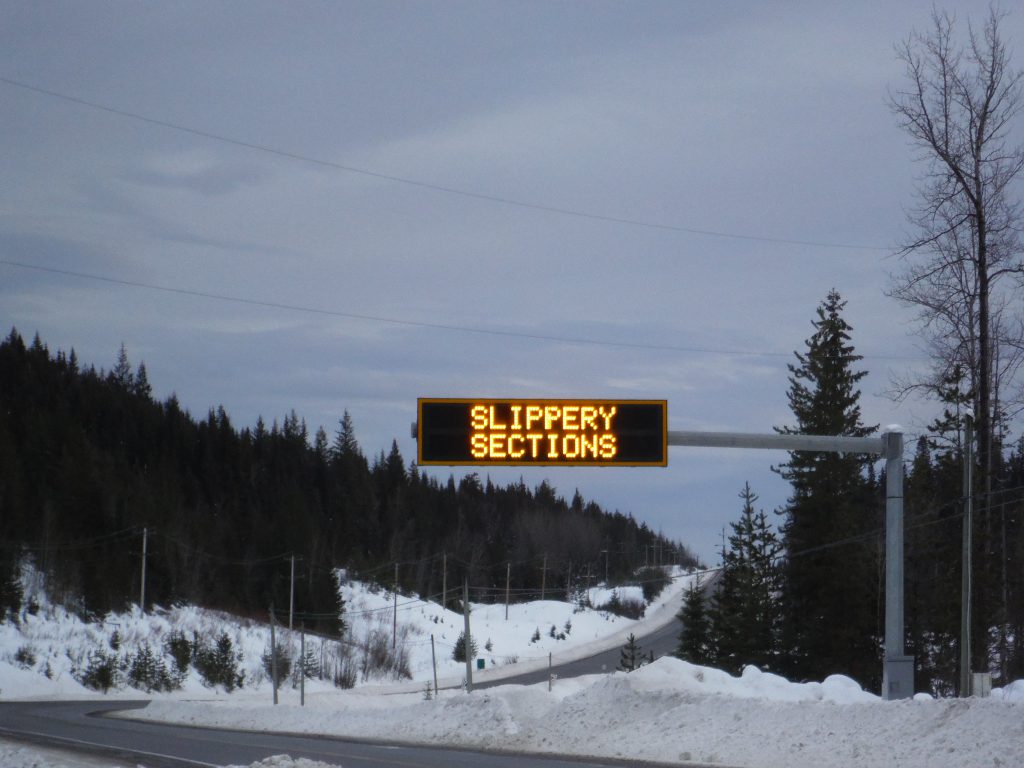
Integrating RWS with our Variable Message Signs
We also use information from our Road Weather Stations to choose appropriate messages for display on nearby Variable Message Signs, warning drivers in real time of hazardous winter weather related road conditions.
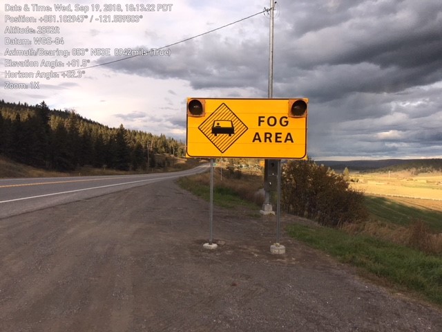
There are seven of these systems in operation around the province, and two additional systems using similar technology to activate LED flashers on static warning signs, like the fog area warning sign, seen below, located in the Cariboo. These systems have proven to be very successful by significantly reducing the frequency of severe crashes on highway segments where they’ve been deployed.
Do you have any questions about this, or anything else we do at the Ministry of Transportation and Infrastructure? Let us know in the comments below.
I’d love to learn how others could integrate this valuable weather information into other weather services. Please get in touch! kempedmonds@gmail.com
Thanks for your interest, Kemp. I see you have a Glacier Media email, as well. We have a media relations team that handles these requests. Please feel free to reach out:
Media Relations 250-356-8241
Thank you muchly! I am not inquiring as a member of the media or Glacier Media, but on behalf of Weatherhood, the hyperlocal weather network I am in the middle of building. Perhaps you can direct my interest in connecting to a more appropriate better party than media relations. Up to you!
This is a really cool system. I often wondered about this when working on the highways paving. Thanks for sharing this info.
Regards,
RJ
Thanks for your message, RJ. Safe travels.
The section of road between Canmore – golden has been ice and compact snow for weeks? What are you doing to make this section safe? Posting “slippery sections” doesn’t feel me with confidence.
Hi Simon. The Trans-Canada Highway in southeastern BC travels through federally-owned Mount Revelstoke, Glacier and Yoho national parks – the latter of which is the BC section you are referring to between Canmore (Alberta) and Golden. These sections are maintained by Parks Canada’s Highway Service Centre. For Yoho National Parks, call Park Canada’s Banff dispatch at 1-888-927-3367. If you’re not sure which national park you’re in, or if you’re even in one of the parks, please call our contractor Emcon Services at 1 866 353-3136 to tell them of the location.
Hi there. I plan to drive from Richmond BC to Dewdney Trunk RD Mission BC on November 11, 2019. I cannot find information on requirements for snow tires for my trip. Can you please kindly let me know if I need to have snow tires for my car to my destination?
Many thanks!
Good morning Ray – we hope you made it Mission safely over the weekend. Both M+S and Winter Snowflake tires are legal on BC highways.
A legal winter tire (on a standard passenger vehicle or a four-wheel/all-wheel vehicle) MUST have at least 3.5 mm of tread depth.
A winter tire must be labelled with either of the following:
The letters “M” and “S”, the minimum legal requirement (mud + snow/all season tires)
The 3-peaked mountain/snowflake symbol (some manufacturers label with both the mountain snowflake and the M+S symbol)
3-peaked mountain/snowflake tires offer better traction on snow and ice. We recommend drivers install 3-peaked mountain/snowflake tires for cold weather driving and, for extreme conditions, carry chains.
However; due to a more temperate winter climate in the Lower Mainland and southeastern Vancouver Island, drivers are not required to use winter tires in many areas along the coast. See the South Coast Map for places where winter tires are needed, like the Malahat. Remember, you are responsible for equipping your vehicle properly for the conditions you are driving in. Many drivers choose to use M+S tires year-round.
https://www2.gov.bc.ca/gov/content/transportation/driving-and-cycling/traveller-information/seasonal/winter-driving/about-winter-tires