When a tsunami warning prompted evacuations to community muster stations in Tofino and Ucluelet this week (the event happened in the early morning of Jan 23, 2018), it highlighted how vital Highway 4 is as an emergency and supply route.
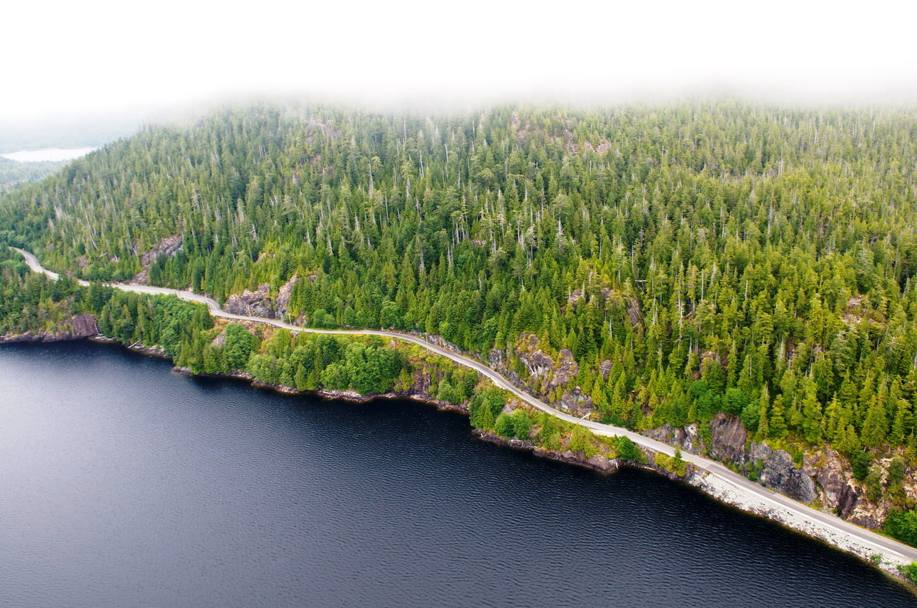
Coincidently, the alert happened the same day we were hosting a public open house in Tofino about the Highway 4 Kennedy Hill safety improvements. The project includes upgrading 1.5 kilometres of steep, curvy road along Kennedy Lake by:
- Widening the highway to accommodate two 3.6-metre lanes, 1.5-metre paved shoulders, and concrete roadside barrier between the lake and the highway.
- Straightening the highway and improving the 30 km/h speed advisories to 60 km/h
- Flattening the 12 per cent grade on the steep hill to 9 per cent, and making the road a 4 per cent grade (or flatter) elsewhere.
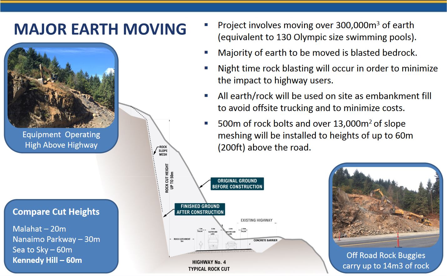
- Eliminating the overhanging rock through extensive blasting and excavation, and reducing rock fall hazards through slope stabilization, as well as a wide rock catchment area and drainage ditch.
- Relocating hydro poles along the project.
- Providing a new rest area facility and viewpoint that uses part of the old highway, including a new intersection accessible to cars, RVs, buses, and commercial vehicles.
In the summer, Highway 4 between Port Alberni and Ucluelet/Tofino gets 4,000 vehicles per day. The safety improvements will not only create a safer route for tourists and locals, it will provide more reliable access should Tofino and Ucluelet need support in an emergency situation.
Of course, it also means we need a solid traffic management strategy to keep traffic delays to a minimum while building the new highway. We have a traffic advisories page to help travellers navigate the inevitable traffic stoppages that come with blasting and hauling bedrock on such a massive scale. The majority of stoppages and blasting will occur at night, outside peak travel times. By developing a coordinated plan with first responders, we will ensure emergency vehicles are always allowed access through the construction site.
There will be some serious earth moving going on during construction, which is anticipated to start March 2018 and finish up by summer 2020. Take a look:
We had three animated video renderings made to help you imagine what the end product will look like. Here are a few details about the videos to keep in mind:
- The relocated hydro pole locations are approximate.
- The new alignment leaves the old alignment between the rest area and the northeastern project limits. The old grade can be seen upslope of the new highway.
- Tall trees can be seen mid-slope on the lake side fill zone. These represent a planting terrace that will accommodate stable soils for planted vegetation to grow.
- Uphill of the rest area parking lot, you can see the switchback trail to the viewpoint lookout. This lookout is on the existing highway alignment at the summit of the hill.
If you didn’t get a chance to tell us your thoughts at the open houses, please do! It’s so important to hear from locals and those who travel to this beautiful, rugged area. Please fill out a comment form and email to us before February 4, 2018.
*POSTED: January 25, 2018
Join the discussion