Are you a visual learner? Some of us here at the Ministry of Transportation and Infrastructure sure are. One of the best ways to discover conditions along your B.C. highways route is to use DriveBC’s map view feature.
The map allows you to view location specific highway information represented by various icons, including:
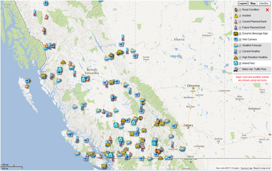
- Road Conditions
- Incidents
- Current Planned Events
- Future Planned Events
- Dynamic Message Signs
- Webcams
- Weather Forecasts
- Current Weather
- High Elevation Weather
- Inland Ferries
- Provincial Rest Areas
- Stop of Interest Signs
To help you make the most out of the DriveBC map view, we have a video in the Touring DriveBC tutorial series. Watch and learn!
Join the discussion