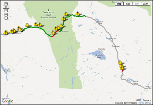
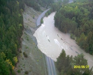
In September 2010 – Highway 20, between Tatla Lake and Bella Coola, was reopened after more than 200 millimetres of rain (a once in every 200 year event) fell over a 36-hour period, flooding the area. The route was impassable at 12 locations. Seventeen days later it was reopened. And, if you drove over it today, you’d see new blacktop coating the damaged sections, stream channels and crossings re-established and traffic signs, once half covered with water, standing tall and bright.
What Happened
Back on Sunday, Sept. 26, 2010, everyone knew that it would take more than bailing buckets to bring the highway back for Bella Coola. Sections of Highway 20, totalling 12.5 kilometres, were damaged, underwater or simply gone. The urgency to address the problem was compounded by the fact the local communities were dependent on diesel to generate electricity for heat, water and other vital services. It was originally thought road access to the communities would take two months to restore…but it had to happen quicker – much quicker.
The Plan

To get the highway reopened, people, equipment and materials were brought in via air, water and land.
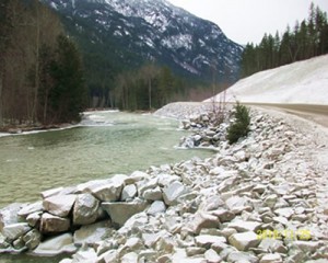
Thousands of tonnes of rip-rap, (rough-hewn rock) were needed to reinforce the banks along waterways and roads; unfortunately the rock drill to do the job was on the other side of a washed out bridge. Within days, an alternate overland route was established to Anahim Lake from Tatla Lake by upgrading an existing forest service road and connecting it to Highway 20. Once land access had been re-established west to Anahim Lake, a rock drill, compressor, bridge sections and pickup trucks were taken there, and transported by heavy lift helicopter to Bella Coola and other sites along the way.
Twenty-five pieces of heavy equipment and explosives to create rip-rap, along with food and fuel, arrived by barge a few days later. With more materials available, work within the Bella Coola valley progressed quickly from both ends of the damaged route.
The People
However, it wasn’t all about heavy equipment; working with the community and considering the sensitivity of the local habitat was also a top priority. The ministry attended daily briefings in Bella Coola to keep locals informed and consulted First Nations to address cultural and archaeological concerns. Ministry environmental consultants worked with environmental agencies, at the provincial and federal levels, to formulate ecologically sound ways to fix the damage to the Bella Coola River and its tributaries – prime salmon habitat.
In all, it was a gargantuan effort which involved the local, provincial and federal governments, First Nations, equipment operators and the ministry’s maintenance contractor, Interior Roads Ltd. More than 100 ministry staff came from across the province to administer and coordinate the work to restore the disaster-damaged roads. Crews worked 24 hours a day. Additional equipment was sourced from companies in Kamloops and throughout the Cariboo area, bringing the response fleet to well over 75 machines at the peak.
The Result
In the end, access to all communities was fully restored in an amazing 17 days. All of the damaged sites are back into service and returned in better condition than they were before, First Nations heritage were respected and fisheries and Tweedsmuir Provincial Park were protected.
October and November are the historical flooding times for the area. Already this fall there has been some flooding in the Bella Coola valley, closing Highway 20 in late September, but thanks to the repairs from last year’s flood, the area withstood more than 220 millimetres of rain over three days. All fingers are crossed that this will be it for the area. If that’s not the case, we’ll be there to help.
For more photos of the damage and the work done to re-establish the area, check out our Flickr set.
We’ve also put together a video telling the story of the Highway 20 flood.


Join the discussion