“This highway, may it serve to bring Canadians closer together. May it bring to all Canadians a renewed determination to individually do their part to make this nation greater and greater still, worthy of the destiny that the fathers of confederation had expected when, through their act of faith, they made it possible. And above all, I express the hope and the prayer today that this highway will always serve the cause of peace, that it will never hear the marching tramp of warlike feet.”
–Prime Minister John Diefenbaker, September 3, 1962
 We wonder what Diefenbaker would say if he could see the Trans-Canada Highway in B.C. now, more than 50 years after he officially packed down the last small patch of pavement at Rogers Pass in front of about 3,000 eager travellers.
Undoubtedly, he’d be relieved to discover the only battles along the 8,000-kilometre route have been fought against natural elements such as avalanches, floods and slides. But to show just how far B.C. Highway 1 has come, let’s take a look way back at the evolution of a few of the route’s most compelling features.
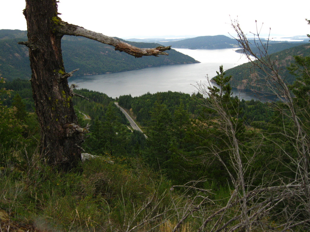
Malahat Drive [Google map]
Some Vancouver Islanders once thought building a road on the east side of the Malahat mountain impossible; but not Major James MacFarlane, who was compelled to survey a direct route to Victoria from his farm in Cobble Hill. Before the first edition of Malahat Drive was built, travellers were forced to make an inconvenient three-day inland journey. Fed up with taking the long way to Victoria markets, MacFarlane successfully lobbied the government to build the modern route and, in 1911, the first automobile travelled the narrow two-lane gravel road over the 350-metre summit. It’s said MacFarlane was actually the first person to cross, with a team of horses.

The roadside view of Saanich Inlet was stunning right from the get-go, but, as you can imagine, driver safety in those days was lacking. Rock and mud slides posed a threat and the mountain road originally had no guard rails protecting its tight curves. A series of safety enhancements over the years have drastically improved the Malahat. The looming rock slopes have been stabilized to prevent slides and concrete median barriers are being added. More than 75 per cent of the Malahat corridor will be separated with median barrier when the project is completed. On average, about 22,000 vehicles travel the 20-kilometre long Malahat every day.
Port Mann Bridge [Google map]
Although the Trans-Canada Highway was officially opened in 1962, it wasn’t fully completed until 1971. One such belated section was the Port Mann Bridge connecting Coquitlam and Surrey, which opened in 1964. At the time, the steel tied arch bridge over the Fraser River had four lanes; a fifth carpool lane was added about 10 years ago. While the original Port Mann Bridge was built when the area’s population was about 800,000, it now feels tread from that many vehicles per week. Queue the Port Mann/Highway 1 Improvement Project.
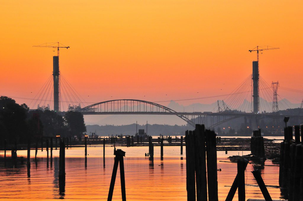
The new 10-lane Port Mann Bridge is the longest cable-supported bridge in North America (two kilometres) and one of the widest bridges in the world (65 metres). Simply put, it’s a massive piece of construction.
Kicking Horse Canyon [Google map]
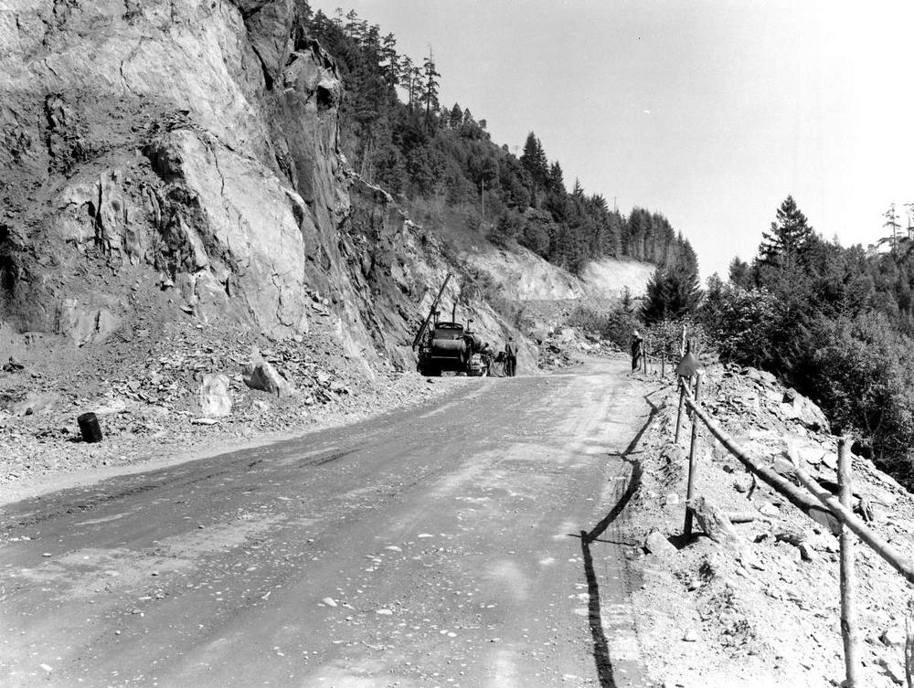
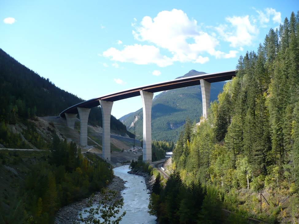
Between Golden and the Alberta border sits Kicking Horse Canyon, the most easterly section of B.C.’s Trans-Canada Highway. It got its name from Palliser Expedition members, who surveyed the pass about 150 years ago, after one unfortunate member got kicked in the chest by a disgruntled pack horse. The original highway was built in the 1950s: two lanes carving between looming rock faces and steep drop-offs, winding through hairpin turns, and two narrow crossings over the Kicking Horse River.
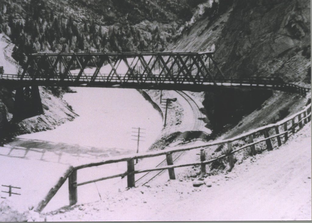
Upgrading this 26-kilometre section of the Trans-Canada Highway was vital for keeping drivers safe and sustaining B.C. as the country’s gateway to the Asia-Pacific market. The first three phases of the project focused on replacing the two major river crossings, cycling improvements, electronic message signs, wildlife fencing and crossings, median barriers and four-lane expansion. Yoho Bridge and Park Bridge were rebuilt and the approaching roadways were realigned. Watch this construction time lapse video to see Park Bridge rise 90 metres from the canyon floor in just two minutes. It’s truly amazing.
Phase four will upgrade more than four kilometeres through the most challenging section of the canyon. Combined with the 1962 creation of the Trans-Canada link through Rogers Pass, the improved Kicking Horse Canyon route reduces travel time between Vancouver and Field, on the Alberta border, to about 10 hours.
It’s safe to say Diefenbaker would be impressed by the colossal improvements to B.C.’s portion of the Trans-Canada Highway. When the province started construction in the early part of the 20th century, it was faced with some of the most challenging terrain in the country. We have since developed innovative ways to support safe journeys and open Canada to the Pacific and beyond. Instead of fearing the “marching tramp of warlike feet,” we encourage international trade and invite the world to explore our landscapes. Perhaps best of all, the Trans-Canada Highway continues to bring Canadians together from coast to coast.

The 4 lane section of number 1 connecting to Alberta should be tolled and then the money from that toll used to accelerate completion of the project Coquihalla style. A toll at the border would get a lot less opposition from BC residents compared to the Port Mann tolls for example.
Thanks for sharing your thoughts and ideas with us.
Hello, I don’t know if this page is even active, but I have to try.
Back in the late 40’s early 50’s my family used to have to drive Edmonton to Vancouver fairly regularly, and part of the highway went over one or two mountain ranges, narrow roads and all gravel. The terminus or start depending on direction of travel was Green wood BC.
Can you tell me where that road went, and if it is still able to be driven. I have many memories of the places and would like ro revist before I die.
Many thanks for ANY help you can give.
Hi there Terri,
Thanks for connecting with us here. Given the dates and description, we wonder if you are thinking of the Big Bend Highway, which ran between Revelstoke and Golden between the 30s and late 50s.
The road is no longer in service (some of it might even be underwater due to damming in the area). The other possibility is that you were travelling the Southern Trans-Canada Highway (which is now BC Highway 3).
Here are a couple of links for you to start your research off:
https://en.wikipedia.org/wiki/Big_Bend_Highway
https://www.macleans.ca/general/a-rough-road-around-the-bend/
https://www.revelstokereview.com/life/the-road-to-nowhere/
http://www.th.gov.bc.ca/controlledAccessHighway/attachedFiles/633149095717520625_0/SOUTHERN%20TRANS-PROVINCIAL%20HIGHWAY.pdf
https://en.wikipedia.org/wiki/British_Columbia_Highway_3
Hello Terri, I randomly came across this post when looking at other things. Given the time frame I suspect you and your family went through Southern BC via Hwy 3. It’s my understanding that many travelers went this way to avoid the “Big Bend” as described by the editor. I think the section of highway you are referring to was the old highway that went from the bottom of Christina Lake to Rossand, and yes, crossed a couple mountain ranges. This piece of highway was replaced by the section referred to as “the Blueberry/Paulson” aka Bonanza Pass, opened in 1962; which goes further to the North and ends in Castelgar. I drove the old road (for the heck of it) around the mid 1980’s and I could see how it would have been quite a ride. Here’s a link, hope you somehow see this.
https://www.ridethekootenays.com/old-cascade-highway/
If I-90 freeway can be plowed through a mountainous Washington State, the same for BC’s Highway 1. Four-laning the entire route is long overdue! It should even be upgraded to freeway status. No at grade crossings, no signalized intersections, more grass medians, bypass towns and cities, 110 km/h speed limit, and more interchanges.
Thanks for your feedback Richard – we have sent your comment to our traffic engineers for consideration.
Unfortunately he would be very surprised that 100 years after he opened it some sections of the highway will remain the same unimproved narrow 2 lanes (if the Ministry manages to keep up the current rate of work on the Kamloops to Alberta Border program).
Hello again Nick and thanks for your comment. We understand the importance of this route and appreciate your concern. Accelerating Highway 1 upgrades between Kamloops and the Alberta border is a specific priority in the mandate letter for the provincial Minister of Transportation and Infrastructure. The Province has committed $464 million to this program over the next three years under Budget 2018. Last week an announcement was made on four-laning 2.5 km between Donald to Forde Station. Here’s a link for more information: https://news.gov.bc.ca/releases/2018TRAN0054-000725
The province might have committed to spending $256 million in the first two of those three years. It actually only spent $95 million because the start of major upgrade projects was delayed. So much for ‘accelerating’ upgrades!
Thanks for your comment, Nick.
It wouldn’t take much to knock his socks off. That road wasn’t even built to the standards of its day let alone today’s standards. The Trans Canada Highway should have been built as a freeway 50 years ago. Look at Interstate 90 which parallels it to the south and runs through states with a fraction of BC and AB’s populations.I’m glad BC is rebuilding the road although it’s 50 years late.
I believe in the planning stages of the TransCanada Highway it was originally supposed to be a free to use with no tolls ever to be imposed for it’s use in any of our Provinces. After some research regarding this I am unable to find any information regarding this. Comments?
Hi Laurie,
We are looking into this for you and will let you know as soon as we have an answer.
Hi Laurie,
We have done a little bit of research but can`t find anything in writing to confirm your idea. We did find this article from Transport Canada, identifying the funding of the TCH as a provincial responsibility – which makes tolling an option provinces can utilize.
http://www.tc.gc.ca/eng/policy/acg-acgd-menu-highways-2153.htm
The Government of Canada is responsible for maintenance and repair inside federal parks (see our blog on that topic here:http://tranbc.ca/2013/06/25/share-and-share-alike-federal-sections-on-provincial-highways/ ).
For a copy of the 1949 Trans Canada Act, please contact the Library of Parliament.(http://www.parl.gc.ca/About/Library/VirtualLibrary/index-e.asp)
Hope this helps!
The Freeway section of the TCH that opened in 1964 and runs from North Vancouver to near Hope was designated as the ‘401 Freeway’ from 1964 to 1973. After that, it became Highway 1, although radio traffic reporters often continued to refer to this Freeway as “the 401”.
At the same time, the Freeway between the Oak Street Bridge and the U.S. Border was designated as the ‘499 Freeway’ from 1964 to 1973. Afterwards, it became Highway 99.
When I was young it seems to me back in 1964 and earlier that the transcanada hwy had a hwy number, such as 401 or 501, I’m not sure which. But after a while everyone just refured to it as the #1.
Can you tell me if this is correct. I can’t seem to find the answer anywhere on the web.
Hi Doreen, interesting question. We’ll do a little digging.