Are you ready? It’s time to hop on board our BC Road Trip Time Machine and travel back to 1966. This time we are driving Highway 8 from Merritt to Spences Bridge, Highway 12 from Lytton to Lillooet and Highway 99 from Lillooet to Highway 97. As many of you already know, we’ve been digitizing 16mm photolog footage from 1966 to give you our BC Road Trip Time Machine video series.
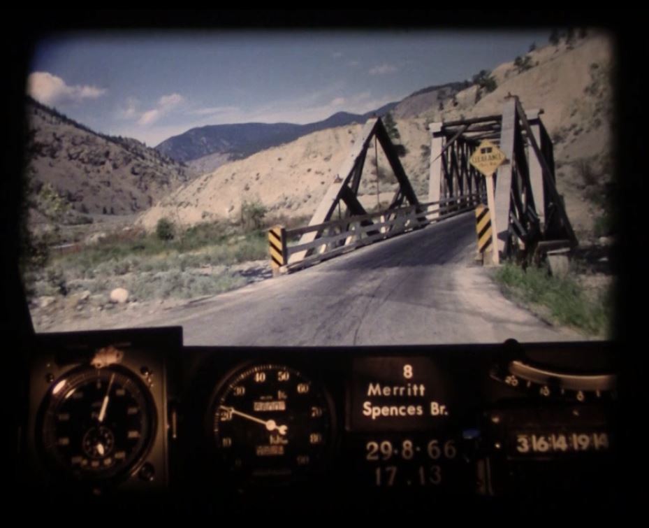
WATCH Merritt to Spences Bridge:
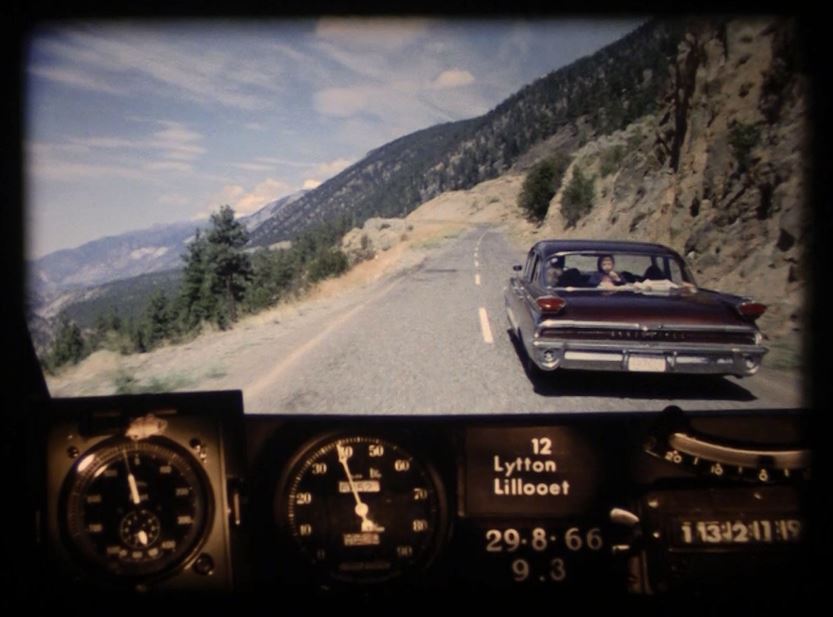
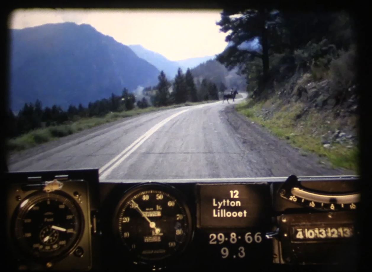
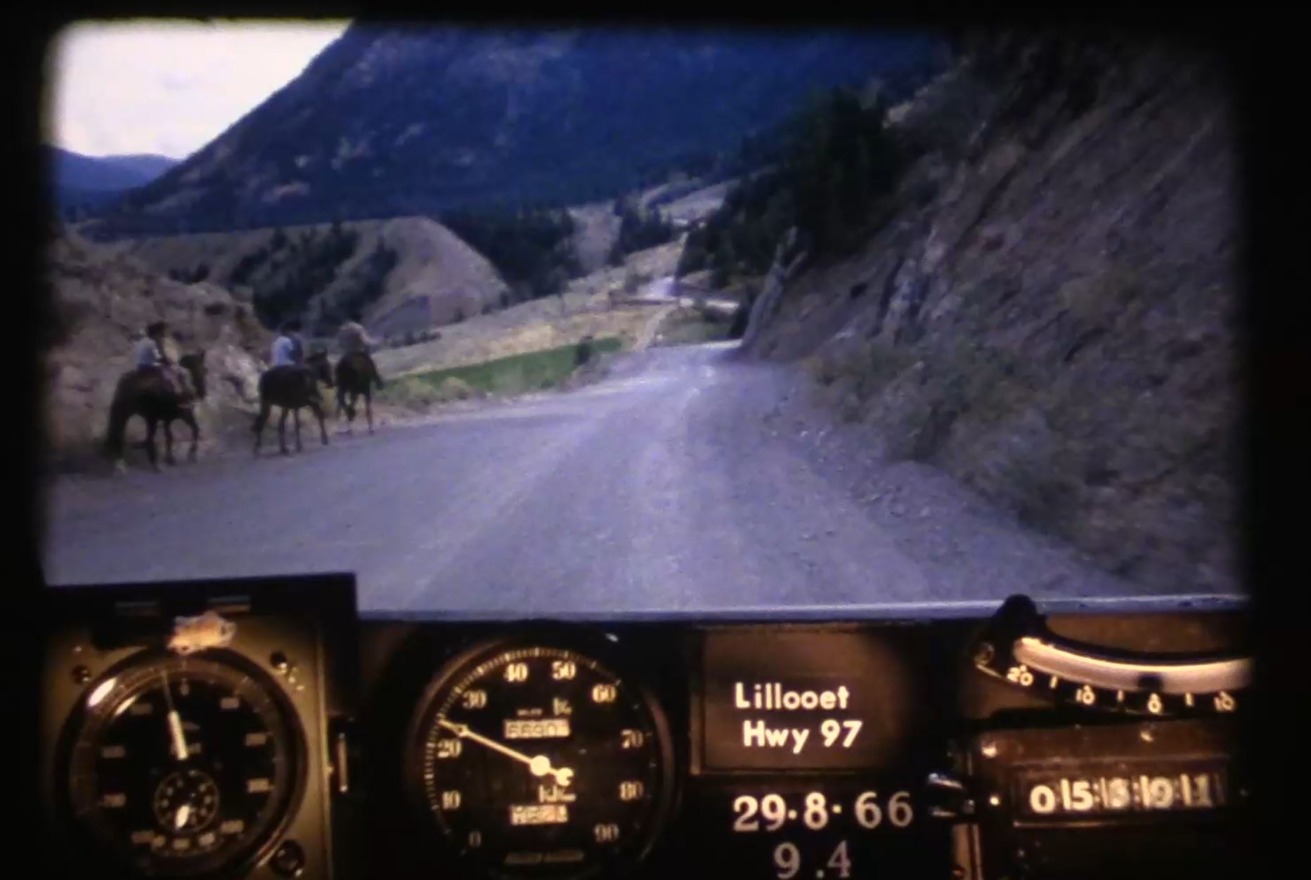
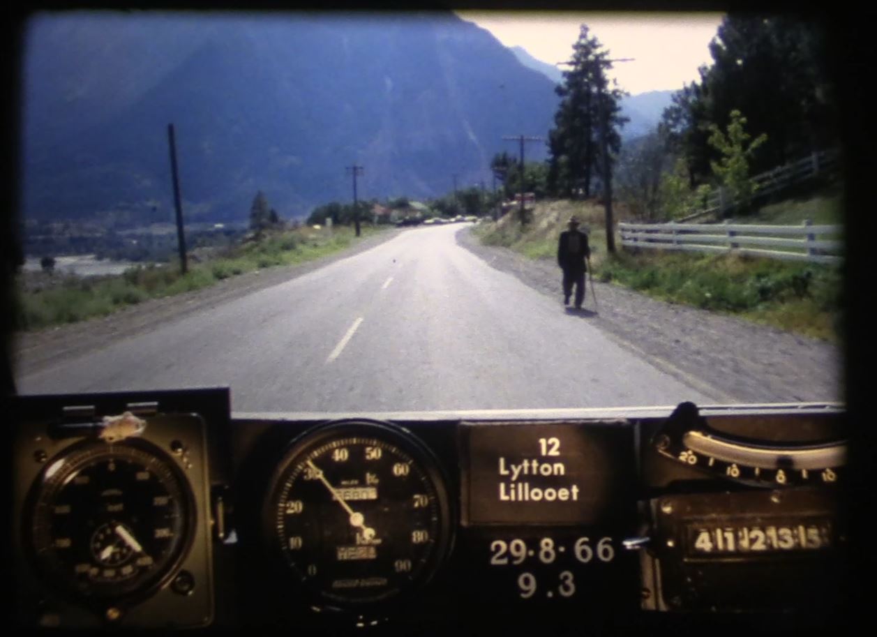
WATCH Lytton to Lillooet:
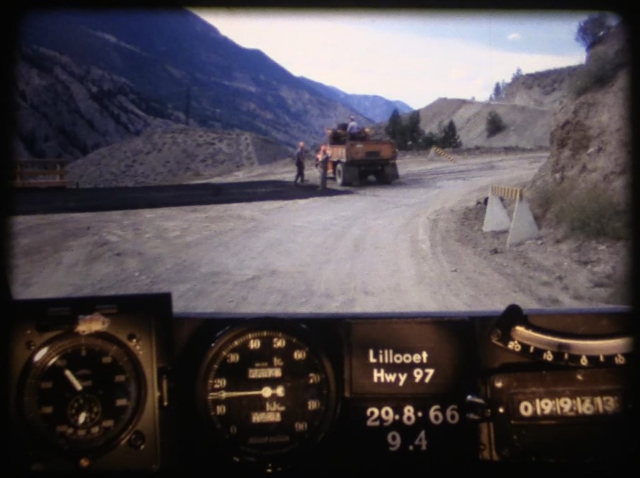
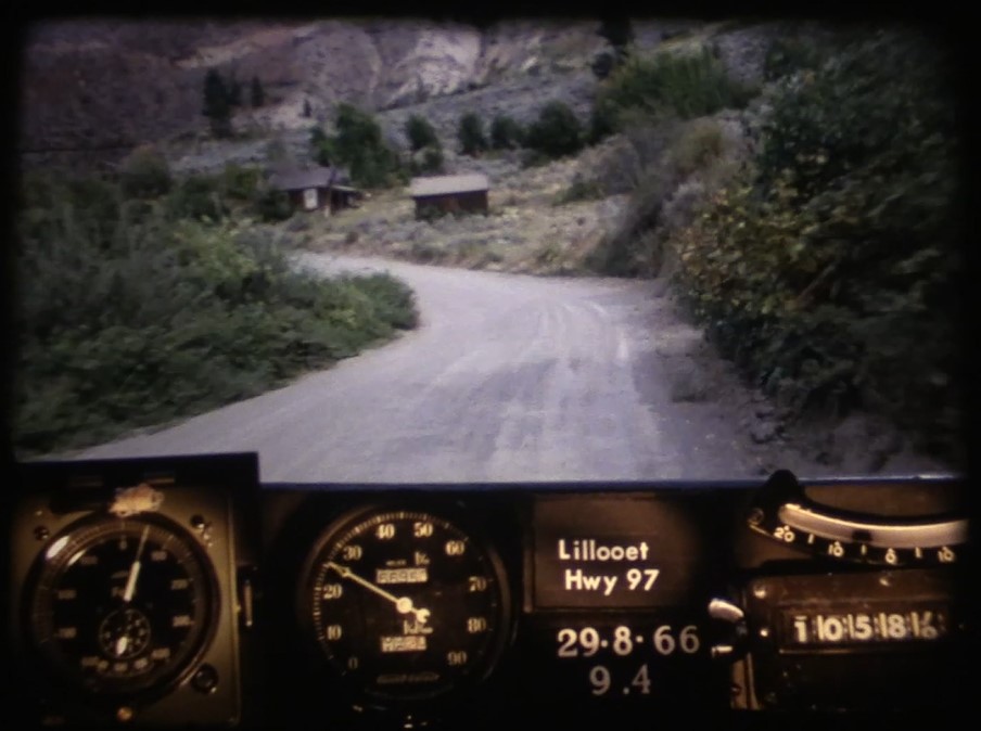
WATCH: Lillooet to BC Highway 97
This is an area of the province rich in history. The Lillooet area is considered to be one of the oldest continuously inhabited locations on the continent, reckoned by archaeologists to have been inhabited years by the Xaxli’p, Ts’kw’aylaxw, (St’at’imc and Secwepemc) first peoples of the area for more than ten thousand years. Although these roads are off the beaten path and remain low volume routes, we’ve made a number of safety improvements to keep travellers safe.
Improvements on Highway 8 include:
- replacement of the single lane truss bridges with concrete 2-lane structures
- shoulder widening in Spences Bridge to accommodate pedestrians
- installation of roadside barriers for safety
Highlights of recent improvements to Highway 12 include:
- installation of roadside barriers for safety
- extensive rock work including scaling and meshing
- new bridges in the area in 2006
- 92 km of paving underway for the 2018 season
Highlights of recent improvements to Highway 99 between Lillooet and Highway 97 include:
- Ten Mile Slide Stabilization Project
- installation of barriers
- widening throughout
- pavement throughout
The Atmospheric River event of November 2021 devastated many stretches of BC Highway 8 and the ministry continues to work to reconnecting this corridor and preventing future loss. Through the B.C. Highway Reinstatement Program, we’re undertaking the long-term reinstatement of critical transportation infrastructure damaged by extreme weather events of November 2021. We will be engaging with communities, local governments, Indigenous communities, and stakeholders to discuss the potential long-term transportation solutions at each project site. Learn more about what the road to recovery looks like for these stretches of highway.
BONUS! Check out some of our favourite still images from this film and from other photologs.
What are Photologs?
“Photologs” were created to capture road condition information across the province and give our engineers the ability to study a particular stretch of road without having to travel into the field. The original photologs were collected by rigging a camera onto the dash of a car that took still images every 80 feet or so and then running them all together as a single film. Pretty cool stuff, huh? Looking back on these old reels reveals a lot more than just pavement condition. The camera captured some incredible glimpses of our province during the 60’s.
Are you patiently waiting to see footage of a particular BC highway that we haven’t shared yet? Let us know in the comments below.
Did you like this content and want to see more? Check out these related links:
- BC Road Trip Time Machine
- A Look Back at the Provincial Sign Shop
- A BC Highways Perspective of the Hope Slide
Join the discussion