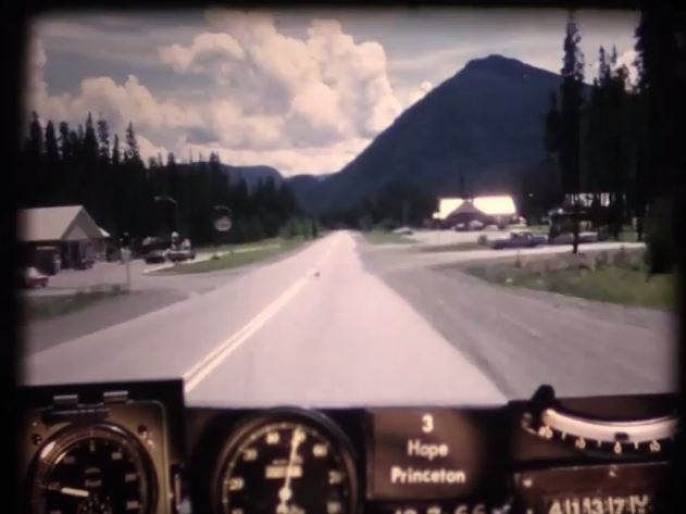
As many of you already know, we’ve been digitizing 16mm photolog footage from 1966 to give you our BC Road Trip Time Machine video series. We love this stuff and you do to. In fact, some of you have loved it so much, you’ve set out on your own road trips to document modern day roads and compare them to our time machine footage – awesome stuff. Get ready for more amazing footage with our latest installment, which takes us from Hope to Princeton on BC Highway 3, as it was in 1966.
What Makes This Footage So Special?
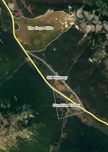
Some of you may know that, a year before this photolog footage was taken, the largest known landslide in Canadian history occurred on this stretch of highway. Devastatingly, it took four lives with it and changed the landscape of the area forever.
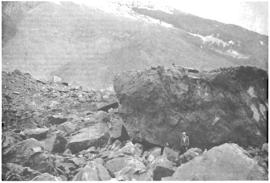
In the early morning hours of Saturday, January 9th, 1965 nearly half of Johnson Peak collapsed and descended into the Nicolum Valley, approximately 20 km east of Hope, destroying nearly four kilometres of Highway 3 (the Hope-Princeton Highway) and filling up the bottom the valley with rock and mud up to a depth of 200 feet. Outram Lake at the foot of the slide area was completely filled with debris.
Department of Highways (our old name) crews worked tirelessly for 13 days in order to re-establish the highway connection and in this photolog video you can actually see the path they cut through the debris to reconnect the road. In the early 1980’s the highway alignment was rerouted around the base of the slide debris field, instead of through it. Visitors to the area today can pull of the highway and visit a monument dedicated to the event.
In the years since the slide occurred, the Hope-Princeton Highway has seen many other changes and improvements including:
- Two lanes in each direction for the majority of the Hope to Princeton stretch
- Ongoing program of bridge replacement
- Safety lights at Skagit Bluffs
- Sunday Summit to Sunday Creek realignment and passing lanes
Before the construction of the Coquihalla (BC Highway 5) in 1986, BC Highway 3 (also known as the Southern Trans-Canada Highway) was one of two primary routes for motorists travelling from the Lower Mainland to the interior of the province and beyond. The other route was the Trans-Canada also known as BC Highway 1, which heads north out of Hope through the Fraser Canyon, toward Kamloops and then east across the province toward Alberta. Have a look at that stretch of road in 1966, here.
What are Photologs?
“Photologs” were created to capture road condition information across the province and give our engineers the ability to study a particular stretch of road without having to travel into the field. The original photologs were collected by rigging a camera onto the dash of a car that took still images every 80 feet or so and then running them all together as a single film.
Looking back on these old reels reveals a lot more than just pavement condition. The camera installed onto the dash of a car and driven over 9,000 km of BC highways captured some incredible glimpses of our province during the heyday that was the 60’s. So sit back, relax and watch this glimpse of a world long gone by in the rear view mirror.
Are you patiently waiting to see footage of a particular BC highway that we haven’t shared yet? Let us know in the comments below.
Join the discussion